Agricultural plot beside E871 near Grigorevo
Category V arable land near Grigorevo, advertised at 4,099 m² with approximately 25 metres of E871 frontage. The road position is a concrete characteristic to investigate. Commercial or warehouse development remains conditional: a 2009 change-of-use process is described as interrupted, with no completed permission established.
4,099 m² agricultural land, category V.
Why we selected this property
The specific features behind our editorial selection.
Explicit agricultural status
The source states category V arable land, keeping the current lawful land character separate from proposed development.
Per source · independent confirmation neededFrontage stated numerically
Approximately 25 m on E871 is advertised, a measurable attribute to verify by survey and road documents.
Per source · independent confirmation neededPlanning history disclosed
An interrupted 2009 procedure is disclosed, giving a specific file to request rather than assumed building rights.
Per source · independent confirmation neededThe property in detail
This is agricultural land, not an approved building plot. The advertiser gives 4,099 m², category V arable use and roughly 25 metres beside E871 near Grigorevo. That combination may interest an agricultural buyer or someone prepared to investigate a longer planning process, but road frontage alone does not establish a lawful vehicle entrance or development capacity.
The source says a change-of-designation procedure was started and an order issued in 2009, then interrupted by a previous owner. No reviewed documents establish whether the order remains effective, which steps can be resumed or what development could be approved. Electricity, water, drainage and road authority consent should be assessed independently.
The asking price is €55,000, with commission due and VAT unspecified. The gallery includes a road-view screenshot, annotated satellite context and a planning-style map. These help locate the advertised setting but are not a current survey or proof of buildable boundaries. Obtain cadastral identification, access documents and written planning advice before costing a business project.
Original EstaSelect editorial analysis · 2026-11-02 · No property inspection
Property facts
Advertiser information, unless otherwise stated. Unknown is kept separate from no.
- Property type
- Agricultural land
- Land area
- 4,099 m², per source
- Current designation
- Agricultural; arable field; category V
- Advertised frontage
- Approximately 25 m on E871
- Planning history
- 2009 procedure interrupted; current effect unverified
- Buildability
- No completed building permission established
- Price and tax
- €55,000; VAT unspecified; commission due
Agricultural land. Building rights or a completed change of use are not established.
What we found in the photographs
Observations tied to specific source photographs. Open a finding to inspect its image.
Supplied road screenshot
A road-view screenshot shows a paved carriageway with trees and vegetation along the edges.
This is context imagery, not proof of current parcel access or a site inspection.Annotated location maps
A satellite view marks a narrow parcel near the road; another map uses coloured land parcels and road lines.
Publisher annotations are not a certified boundary survey or an effective planning approval.Photographs do not establish structure, legal status, hidden services or permanent views.
What deserves a closer look
01A completed change of use and building permission are not established.
02Frontage does not itself establish approved vehicle access from a main road.
03The supplied maps and road screenshot do not prove current boundaries or connected utilities.
Understand the location
Grigorevo · Sofia region · Approximate area, not the exact address


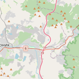
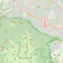


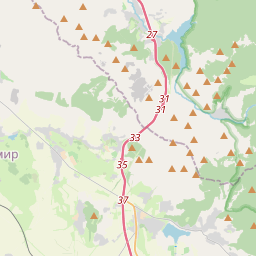
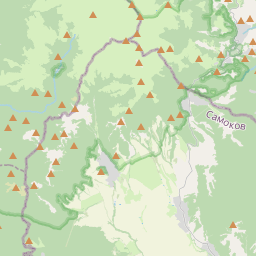


Map markers show approximate areas, not verified property addresses.
Price in context
Selected same-use offers in the same city. Asking prices, not completed transactions.
| Property | Advertised area | Plot | Price per m²* | Asking total |
|---|---|---|---|---|
| This propertyGrigorevo · Sofia region | 4,099 m² | 4,099 m² | €13 | €55,000 |
There are not enough sufficiently comparable current offers in our local selection. No broader market-value conclusion is drawn.
*Total asking, including stated mandatory extras, divided by advertised area. Net area, common parts, basement, land rights, condition and micro-location may differ. This is a comparison starting point, not a valuation.
What to check before deciding
What is the cadastral identifier, current sketch and exact surveyed frontage?
Can the complete 2009 file and written confirmation of its current legal effect be supplied?
Is a lawful road entrance approved, and by which road authority?
What planning restrictions, easements and setbacks apply to this parcel?
Are there agricultural leases, occupied crops or third-party use rights?
Where are utility connections, what would connection require, and what VAT and fees apply?
What the analysis is based on
- Source review
- 2026-11-02
- Gallery
- 7 images available
- Visual sample reviewed
- 3 · № 1, 4, 7
- Documents / inspection
- Not reviewed / not carried out
The specific offer remains presented for sale on the public advertiser page. This is a public listing signal, not seller confirmation of availability.
BULGARIAN PROPERTIES · Sfa 90739
Original listing and advertiser contactThe selection, in summary
Five criteria, with their evidence in view. An unassessed criterion stays unscored; missing information is not zero.
Rating not calculated. The available evidence is not yet sufficient for a defensible overall result.
No example or average pointsWhat the property information tells us
VAT treatment needs confirmation. Confirm commission and any additional mandatory charges with the advertiser. No market-price score has been calculated for this property. It requires suitable, independently checked comparisons with consistent area, tax and rights definitions.
Open price contextWhat the property information tells us
Grigorevo · Sofia region Check the cadastral position, lawful road access, easements and actual utility connections. A map pin does not prove access rights.
Inspect the locationWhat the property information tells us
Land area: 4,099 m², per source. Current designation: Agricultural; arable field; category V. Confirm usable areas and rights against approved documents. More advertised square metres do not automatically earn more points.
Review the property factsWhat the property information tells us
A road-view screenshot shows a paved carriageway with trees and vegetation along the edges. Check title, land classification, planning rules, utilities and restrictions independently.
What the property information tells us
A completed change of use and building permission are not established. Frontage does not itself establish approved vehicle access from a main road. These are matters to investigate, not proof of extra building rights, rental yield or future profit.
Review the checks before decidingWhy selected: The source states category V arable land, keeping the current lawful land character separate from proposed development.
Proposed scoring method
The weights describe the proposed structure, not points awarded to this property. Once the method is calibrated, confirmed levels from 0 to 5 would convert to points as weight × level / 5.
A numerical rating requires a consistent method for the property type, suitable independent market comparisons, and an editorial review of the evidence for each criterion. Listing claims, photo observations and unresolved questions must remain distinguishable.
An overall result remains unpublished when the evidence is insufficient. Missing information is not zero; example or average points do not replace it. The current card presents the available evidence without assigning points.
Our selection principlesLooking for a similar property?
Save your criteria and revisit the source-backed collection.